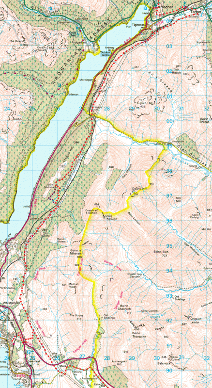
From Garelochhhead to Arrochar and Tarbet: 20.5km, 12.7 miles; ascent about 490m.
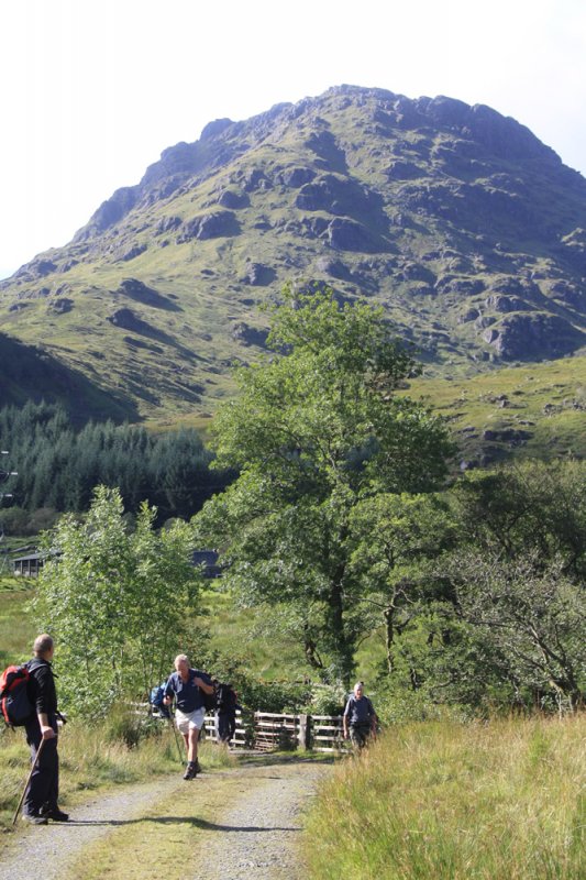
The southern two thirds of this section takes you through the Garelochhead military training area, initially on the lightly used tarmac "Yankee Road" and then almost entirely on remote forestry roads and landrover tracks. North of Glen Douglas the scenery is outstanding .
Map files courtesy of Argyll and Bute Council. Reproduced by permission of Ordnance Survey on behalf of HMSO. © Crown copyright and database right 2009. All rights reserved. Ordnance Survey Licence number 100023368
Beginning at the southern end of the Yankee Road, 261899, spot height 197, simply follow the reassuring HADAT sign posts and waymarkers which make route finding relatively easy through the military training area. The route from Garelochhead starts about half way up Station Road near 242912 where a finger post points the way up a SUSTRANS cycle path. At the roundabout, cross the A814 and follow the Three Lochs Way signs to gain the "Yankee Road" at a gate near 250916.
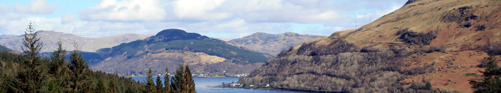
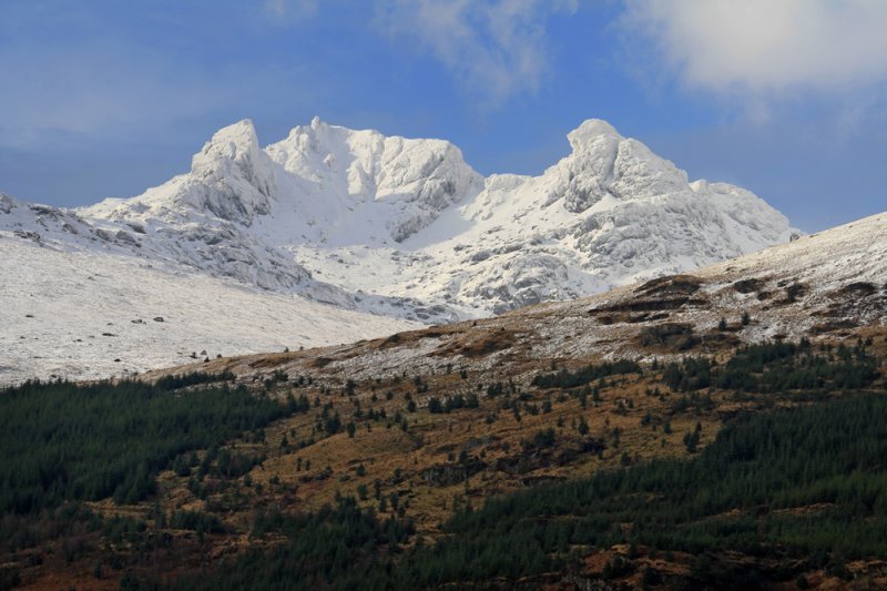
After a rather bleak and inauspicious start, the Yankee Road soon begins to give outstanding views to the south and west over the huge 'HM Naval Base Clyde' and Garelochhead while to the north west the knobbly outline of the ironically named Argyll's Bowling Green looms up offering a foretaste of the magnificent mountain scenery to come. The pronounced gap in the 'Bowling Green' known as 'The Duke's Pass' was indeed used in the past by the Dukes of Argyll when journeying between Inveraray Castle and the royal court in Stirling or Edinburgh.
In Glen Malan, around Grid ref. 258964, a very boggy section is now much improved thanks to the men of 70 Gurkha Field Support SQDN who constructed a 200 metre long Gurkha "Bato"(road) here. At the end of the 'bato' cross the bridge. Turn left and pick up the rough trod within the larch trees, follow the indistinct landrover track north to cross the Glenmalan Burn by the bridge dedicated with a small plaque to Senior Warrant Officer, Dave Markland. Dave did the early project management in connection with the Gurkha Bato, but sadly he was killed in Afghanistan in 2010. With Access Trust volunteers doing a lot of the dismantelling, moving and re-construction work, the bridge, sourced second hand from Argyll and Bute Council, was installed in the Autumn of 2012. Having crossed the bridge, simply follow the track uphill to the main Craggan Hill forest road where you turn right and after about 3km come to Glen Douglas.
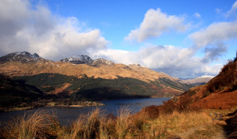
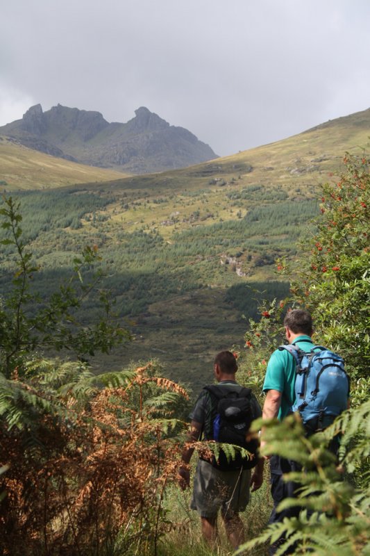
Emerging from the northern end of the training area in Glen Douglas near Creagan Sithe, turn 2nd right at grid ref 274002 onto the minor road (careful not to confuse it with the military road which runs parallel to the public road). Within a few metres cross the West Highland railway before turning left onto a gated landrover track. Soon, superb views open up across Loch Long to the "Arrochar Alps" and this is perhaps the most scenic section of the Three Lochs Way. The abandoned and recently excavated 'fermtoun' of High Morelaggan is worth a short detour (signed) down and through the railway sheep creep at grid ref. 278015. Arrochar is reached after 5km and Tarbet after 7.5km.
Shortly after the bridge over the Tighness Burn a signpost indicates the access to Arrochar via a low headroom 'sheep creep' under the railway at grid ref. 297035 and down a greatly improved path to Church Road.
The main route continues along the landrover track to Tarbet, which is reached after a further 2.5 km or so. As you near Tarbet look out for the heritage trail information panel that tells some of the history of the area. An obvious landmark on the north side of the glen as you approach Tarbet is the old Ballyhennan Church (now Slanj Restaurant and local shop) which marks the northern end of this section of the Three Lochs Way.

Our Funding Partners


 The Three Lochs Way is managed and maintained by the voluntary efforts of members of Helensburgh & District Access Trust which urgently requires funding for improvements to the route. Find out more on how you can help.