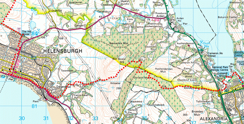
Balloch Tourism Information Office to The Hill House in Helensburgh: 14.5km, 9 miles; ascent about 400m.
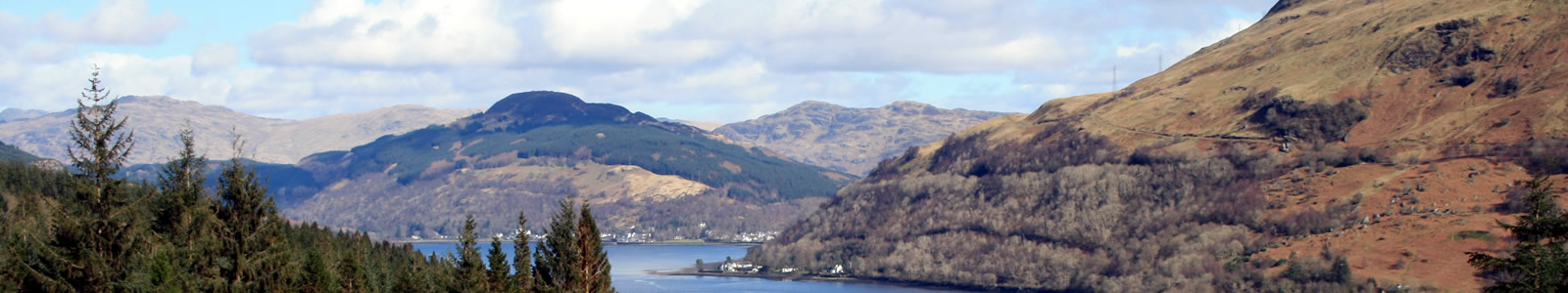
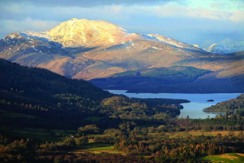
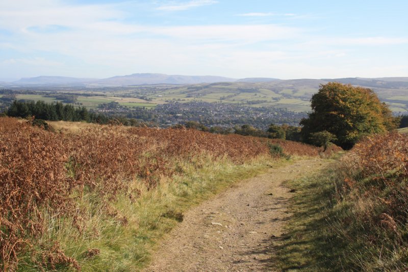
Utilising existing minor roads, a historic right of way, forest roads, footpaths and informal trods, this section crosses the Killoeter/Ben Bouie upland between Balloch and Helensburgh. The route gives excellent views over Loch Lomond, Helensburgh and the Firth of Clyde.
Those cycling will find a continuous cycle path beside the A82 and A818 linking Balloch and Helensburgh. The dedicated mountain biker will of course think nothing of tackling the upland route as described - there are some brilliant descents - just be prepared to do a bit of pushing to get up the steep bits!
Map files courtesy of Argyll and Bute Council. Reproduced by permission of Ordnance Survey on behalf of HMSO. © Crown copyright and database right 2009. All rights reserved. Ordnance Survey Licence number 100023368
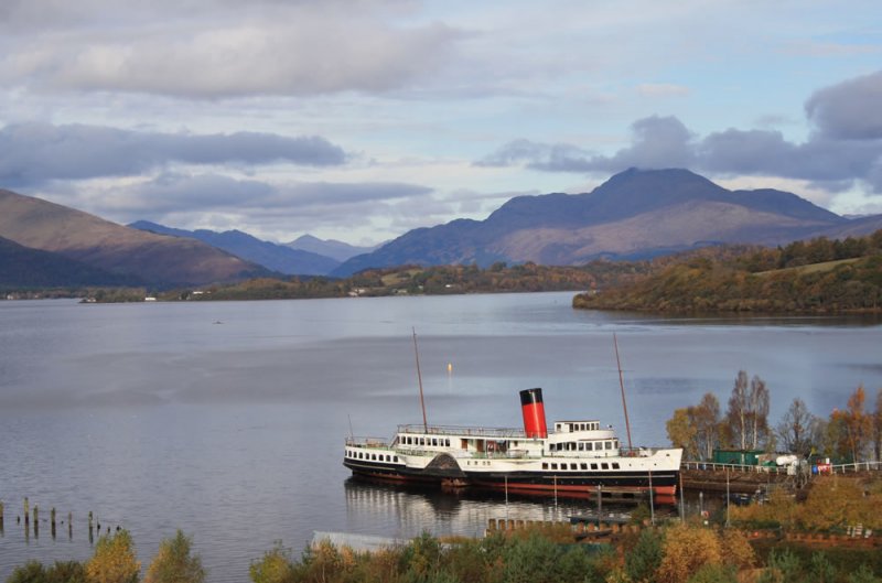
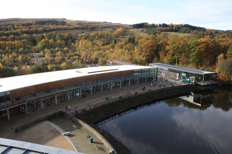
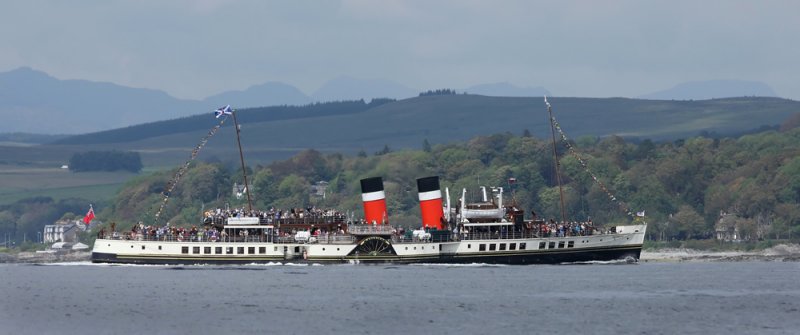
From the Balloch Visitor Information Centre (opposite the railway station) start by heading east for a few metres before turning north into the riverside car park. At the north end of the car park pick up the riverside walkway and follow for 500 metres to edges of Loch Lomond. A short detour will take you to Balloch Pier where you can see the Paddle Steamer Maid of the Loch, currently under restoration on the slipway by the loch. At weekends between Easter and the end of October you can visit the historic winch house and museum cabin which relates the unique story of this ship, slipway and the work of the dedicated volunteers. You can also enjoy enjoy the best view of Loch Lomond and some great coffee year round at the Pier Coffee House. Continue around the lagoon and walk through Loch Lomond Shores retail complex.
At the western end of the "retail crescent" turn left and walk 400 metres southwest on the pavement fringing the large car park until you reach the Old Luss Road where you turn left, walking for 250 metres before turning right onto the ancient drove and coffin route known as 'Stoneymollan Road'.
After about 400 metres or so the lovely old road is cut by the A82 and a pedestrian overpass takes you across the busy carriageway.
Continue following the Stoneymollan Road uphill where after 600 metres you pass through a gate. The route now becomes a rough track which you follow uphill for a kilometre or so before passing through another gate into a forestry plantation.
After 450 metres a waymarker indicates a right turn at the crossroads. Follow the forestry road 800 metres to the Darleith Muir T junction at GR 352822.
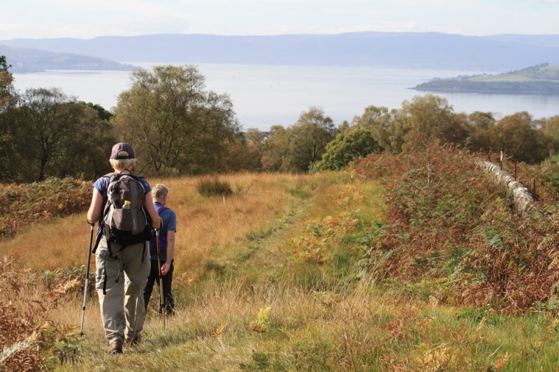
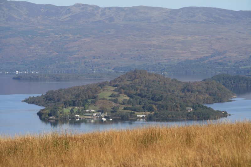
As indicated by the waymarking post, turn right at the Darleith Muir ‘T’ junction and head along the path which heads northwest over the steep Killoeter Escarpment. Up on the plateau a signpost indicates a short detour along a reddish coloured path out to spot height 281on Goukhill Muir where you will be rewarded with stunning views over Loch Lomond.
100m SW of the viewpoint at 344828 take a left following the TLW signpost down over the Camis Eskan path to Helensburgh.
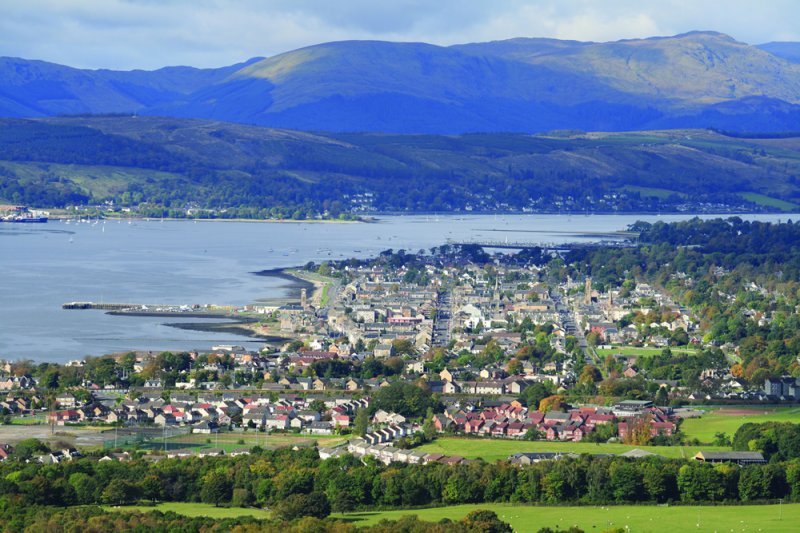
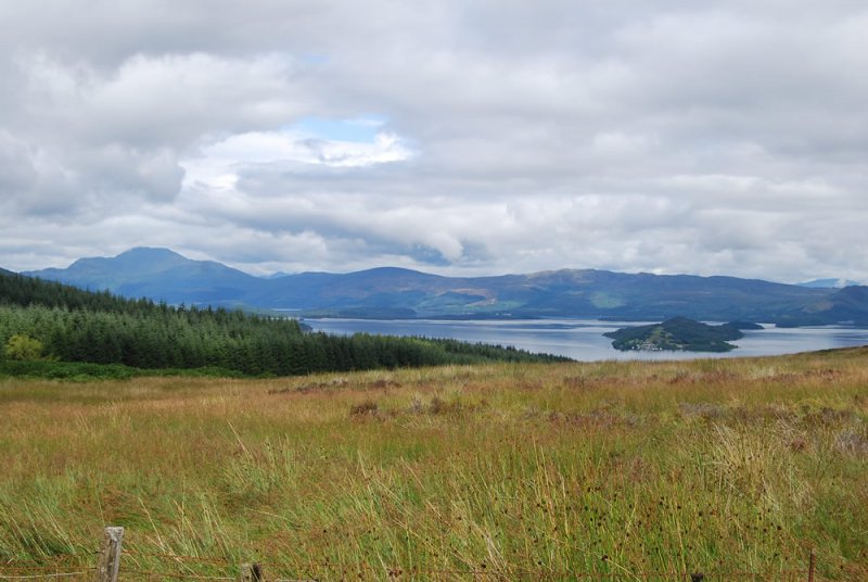
Taking the Camis Eskan route, a fence opening is reached in a little under 200m. A path descends towards Helensburgh through the Camis Eskan forestry plantation and soon gives grand views over the town, the Firth of Clyde and Glen Fruin. Continue down the path until you cross a forestry road near Northfield Wood at grid ref 332821. A sign here points the way down the attractive Red Burn trail which leads down through Quarry Wood to a forestry road where a left turn takes you through a disused sheep fank.
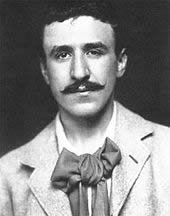
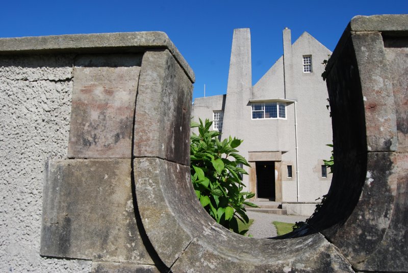
After the fank the track heads down towards a green metal clad barn. Just past the barn follow the tracks downhill to the housing areas and main A814 road into Helensburgh. This first section terminates on the northern outskirts of Helensburgh at Charles Rennie MacIntosh's The Hill House. The route shown - along East Clyde Street and then up Colquhoun Street - passes the town's three railway stations so is convenient if you are walking the route in shorter section and returning to home or other accommodation.
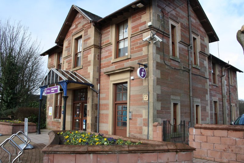
There is a Destination Helensburgh visitor information centre near bottom of Sinclair Street. Don't miss some short detours to explore the leafy back streets, where you can admire the fine gardens and stone built Victorian and Edwardian villas for which Helensburgh is justifiably renowned. In late April early May you'll find the town's spectacular collection of streets trees in a froth of pink and white blossom. A good range of accommodation and a rich variety of eateries will enhance your time in this unique town.


Our Funding Partners


 The Three Lochs Way is managed and maintained by the voluntary efforts of members of Helensburgh & District Access Trust which urgently requires funding for improvements to the route. Find out more on how you can help.